When Water Flows, Part 2
Natural and Unnatural Erosion and Its Consequences

In the first of this pair of posts, I talked about some basic physical properties of moving water and sediment. MovingI water has to transport sediment, and the amount depends on the velocity of the water, the volume, the available particle sizes, and other factors. Moving water also sorts its sediment load by size, with the largest and heaviest particles the first to fall out of the flow. In this second part, I discuss “unnatural” or human-caused erosion and the problems it creates.
Unnatural Erosion
As mentioned earlier, Iowa’s landscape is altered from the pre-settlement prairies, wetlands, woodlands, and aquatic environments. Our streams no longer exist in a natural condition in which rainfall alone creates the riffle sequences and point bars or in which floods are free to expand across the bottomlands. Bridge abutments, dams of many sizes, development of floodplains, dikes, stormwater discharges, field tile outlets, and surface erosion have made permanent changes.
The high runoff rates from human occupation have led most creeks and rivers to become incised, meaning that their channels have deepened considerably. This denies them access to their natural floodplains except during moderate to severe floods. In streams I have studied, the rim of the bank marks the average two- to five-year flood return, and those are shallow floods that do little harm so far as we are concerned. They are deep enough to produce some changes in the channel shape and to move sediment.
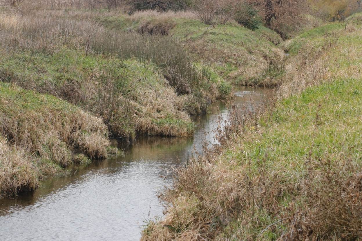
Channel incision on Calamus Creek, a tributary of Indian Creek of the South Skunk River. Before human land changes, the creek probably lacked a channel and consisted of wet meadow vegetation. The low angles of the land above the banks probably met to form a shallow waterway. Now, high flows have a difficult time accessing those low slopes as part of their floodplain.
Unless protected by a dike, those same streams require an average return period of six or more years, including the ten-, twenty-five-, fifty-, hundred-, and 500-year cycles. The last can overwhelm even dike systems, and they cause damage to crops, crop land, bridges and roads, utilities, residences, and commercial property.
Large streams “prefer” to make those lazy S-bends in the Midwest, but many have been channelized or straightened for several reasons. Many now recognize this as a serious blunder, but restoration of rivers like the Cedar, Des Moines, Little Sioux, Middle, Raccoon, and Skunk to their meanders would cost billions of dollars and require a monumental hydrological analysis. The problem with channelization is that the distance from points A and B on the river has been shortened, leading to faster, higher-volume flows that carry away the banks on both sides. The channels tend to be broad, two or three times as wide as the unstraightened river in order to handle monster floods.
The stream bed of a channelized section of the Iowa River at Timmons Grove Park, Marshall County. The river is much deeper and wider than when it coursed through meanders on either side. At low flow, shown here, almost no water moves across the sandy bed.
There is at least one method for estimating the loss of soil from the banks of an outside bank cut or the banks of a channeled river, and the results, usually stated as an average annual tonnage, are astounding. The differences in width and other two-dimensional changes are often more than obvious from aerial photography, of which Iowa has numerous full sets from the late 1930s to present.
Another change that shows up is the “Butz effect,” when agricultural policies shifted to international trade during the Nixon administration. President Nixon visited the People’s Republic of China in the 1970s and opened up trade for farm commodities; Iowa’s streams formed more headwater gullies and ravines because of that and later trade agreements. Comparison of 1960s to 1970s aerial imagery often reveals the headcutting that lengthens streams upslope and the gullying that takes place as land is cleared and put to the plow.
The science of hydrology was advanced enough by the 1940s that, had engineering companies and policy makers paid attention, much of the damage from channelization, land clearing, and further intensification of cropping and pasturing might have been avoided. The aerials of Timmons Grove Park in Marshall County are a case in point, with abandoned meanders of the Iowa now grown to woods and the arrow-straight Iowa channel dividing the park into north and south parts.
And then there are dams. Every one of them has a “dam” problem: flow slows behind (upstream from) the dam, causing sediment deposition. Over time, the reservoir becomes ever shallower, until major parts of it convert to mudflats and wetlands. Saylorville Reservoir (“Sewerville”) is a well-known example, with the floodpool below Jester Park now a mudflat with a new channel for the Des Moines River. Downstream from any dam, the loss of sediment above leads to sediment capture by the water (recall that flowing water must carry sediment) along the channel banks. The river from the dam into northern Des Moines shows evidence of this inducing scouring, which would be worse if not for thousands of tons of limestone rip-rap. (By the way, the rip-rap mainly extends the inability of the flow to carry the sediment it needs for a greater distance.)
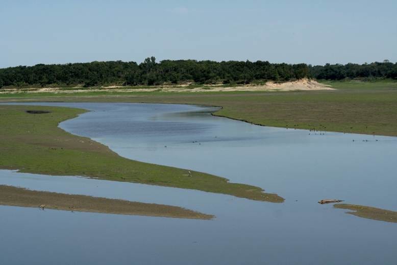
Vegetated mudflats and the recently formed Des Moines River Channel in upper Saylorville Reservoir. The amount of sediment is a testament to water’s destructive power when it is disturbed from its natural balance.
John Wesley Powell, who famously explored the Colorado River on two expeditions and set out a wise plan for water use in the western states, would have shaken an angry finger at most dams in Iowa. When he oared a boat from the Mississippi up the Des Moines in 1858, the river must have looked quite different from today’s.
We have shaken our fingers at past agricultural practices and created federal and state services to minimize erosion: crop terraces, grassed waterways, bioretention cells, prairie strips, saturated buffers, and on and on. Old crop terraces are not wide enough for today’s implements; grassed waterways have needed repair and extension because of advancing erosion; the practices in the Iowa Department of Agriculture and Land Stewardship have had a poor reception, meaning that the department falls short of its “land stewardship” mission.
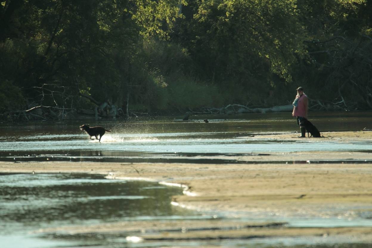
Meanwhile, our streams are choked with sand, which destroys habitats for game fish, mussels, and entire aquatic food webs. Where the clay and silt stop I cannot say; perhaps upstream from the next reservoir or lock and dam, or else as far downstream as the coast of Louisiana. Between sediment and water pollution, we are tied to Louisiana through the economic demands and politics of ecology and the flowing water of the Mississippi.
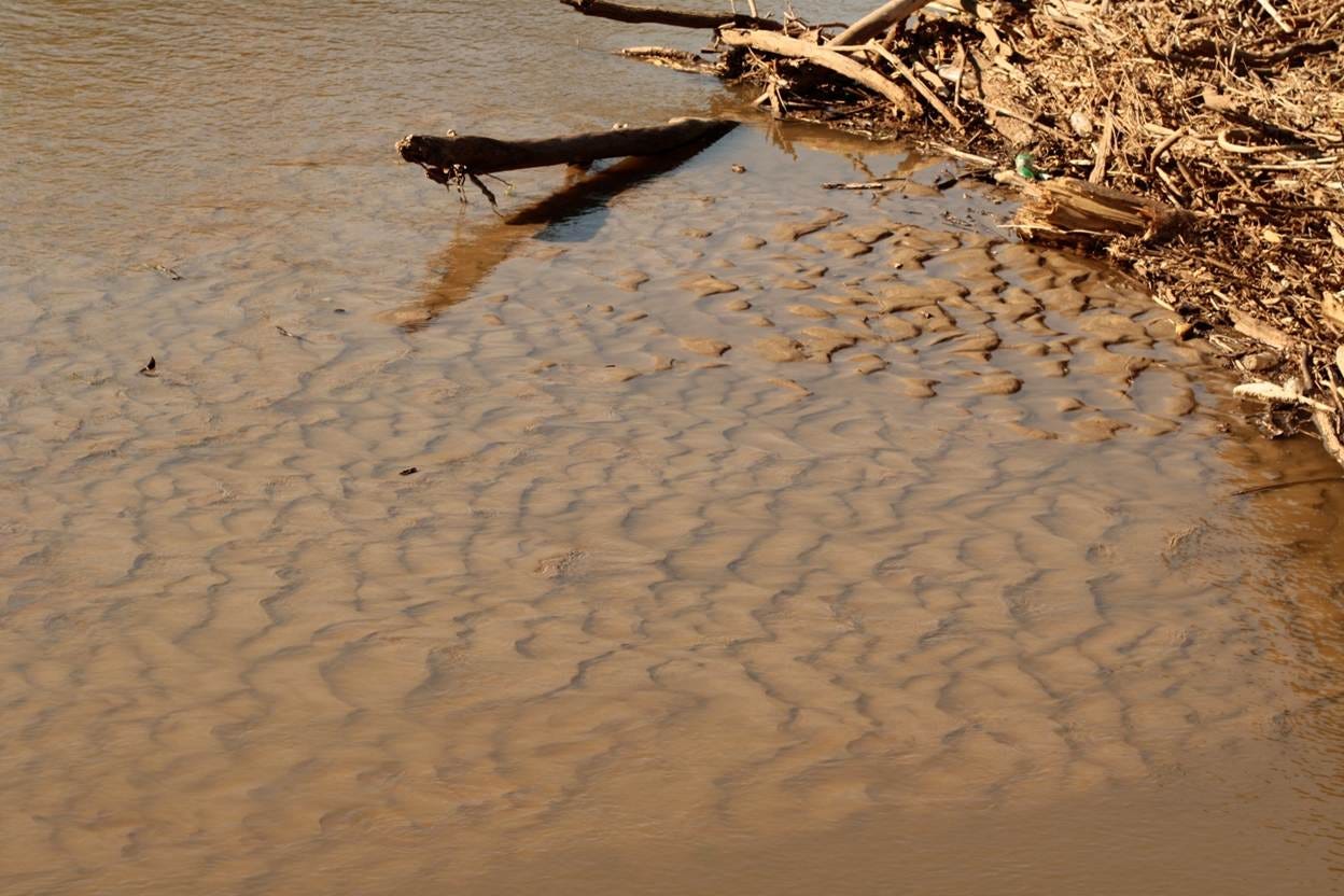
Ripples in deposited sand along the Lower Raccoon River in western Des Moines, Iowa. The amount of sand in Iowa’s streams comes largely from changed land uses and human disturbances upstream. In some cases, the stream’s energy is unable to manage the amount of sediment, making it hydrologically “incompetent.” This situation has not always been true.
Leland Searles
May 19 & 26, 2026
One of the mist dramatic and drastic aspects of our "altered state" is the relatively sudden transformation from an almost entirely groundwater-driven hydrology ro an almost entirely surface-water hydrology designed to quickly shed water.